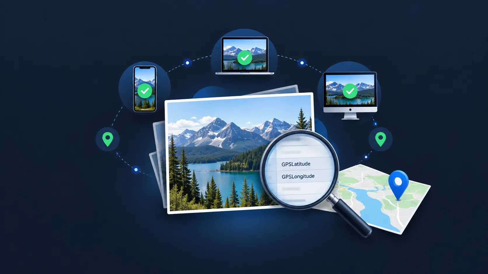
How to Check If a Photo Is Geotagged: Find GPS Location in EXIF Metadata
Every photo taken with a smartphone potentially contains more than just the image itself. Embedded in the file's metadata, there may be GPS coordinates that record where the photo was captured. This data is called a geotag.
Knowing whether a photo is geotagged matters for privacy, for SEO, for journalism, and for everyday situations where you simply want to confirm where an image came from. The good news: checking is straightforward on every major platform — but it is important to understand the difference between a location shown by a photo app and GPS coordinates actually embedded in the image file.
This guide walks through how to check if a photo contains embedded GPS location data on iPhone, Android, Windows, macOS, and through browser-based tools — plus what to do once you know.
What Does "Geotagged" Mean?
A geotagged photo is an image file that contains embedded GPS coordinates in its EXIF (Exchangeable Image File Format) metadata. When your phone or camera has location services enabled, it records coordinates at the moment the photo is taken and writes this data directly into the image file.
The key fields to look for are:
- GPSLatitude — the north/south coordinate
- GPSLongitude — the east/west coordinate
- GPSAltitude — elevation above sea level (not always present)
If these fields exist and contain values in the image file itself, the photo is geotagged. If they are empty or absent, the file has no embedded location data.
Important distinction: embedded GPS coordinates are recorded location data from the device and are generally more authoritative than AI-based location estimation. However, their accuracy depends on the device and the quality of the location fix at the time of capture. Smartphones may determine location using GPS satellites combined with Wi-Fi, cellular, and other location services — so "GPS coordinates" in EXIF may reflect a composite location fix rather than pure satellite data.
Also important: a photo app showing a location on a map does not necessarily mean GPS coordinates are embedded in the image file. Some apps display locations that were manually added, estimated by the app, or sourced from other signals. To confirm that EXIF GPS data actually exists in the file, you need to inspect the file's metadata directly.
Quick Indication: Built-In Photo Apps
Built-in photo apps on your phone or computer can give you a quick indication of whether a location is associated with a photo. However, the location shown by these apps is not always proof that GPS coordinates are embedded in the image file.
iPhone
Open the photo in the Photos app. Tap the photo to view it full screen, then either swipe up or tap the ⓘ (info) button.
If location information is associated with the photo, Photos displays a map and location name. This is a useful quick indication, but the location shown in Apple Photos may come from the embedded EXIF GPS data, from location data added manually, or from other sources within the Photos database.
To confirm that the original image file itself contains embedded GPSLatitude and GPSLongitude fields, inspect the file with a dedicated metadata viewer such as the GeoImageTagger Metadata Viewer or ExifTool.
Android / Google Photos
Open the photo in Google Photos or your device's default Gallery app. Tap the photo, then either swipe up or tap the three-dot menu and select Details or Info.
Google Photos can show a location associated with an image, but that location is not by itself proof that GPS coordinates are embedded in the file. Google Photos may display a location that was saved by the camera, manually added by the user, or estimated by Google Photos itself.
To confirm that embedded EXIF GPS coordinates exist in the image file, inspect the GPSLatitude and GPSLongitude fields with a metadata viewer or ExifTool.
Confirming Embedded GPS: File-Level Methods
The following methods check the actual image file for embedded EXIF GPS fields — giving you a definitive answer.
Windows
Right-click the image file in File Explorer and select Properties. In the Properties window, click the Details tab.
Scroll down to the GPS section. If the file contains embedded GPS data, you will see values for Latitude and Longitude (displayed in degrees, minutes, seconds format). You may also see Altitude.
If the GPS section is empty or does not appear, the file does not contain embedded GPS coordinates.
Note: Metadata support and what your operating system displays varies by file format and application. If the built-in file inspector does not show GPS fields, use a dedicated metadata viewer or ExifTool before concluding that no location metadata exists.
macOS
Open the image in Preview (the default image viewer). Go to Tools → Show Location Info.
If the image contains location data, Preview will display the location on a map. If "Show Location Info" is unavailable or greyed out, Preview does not detect location information in that file.
For power users, ExifTool in Terminal provides the most detailed and reliable check:
exiftool -GPSLatitude -GPSLongitude photo.jpg
This prints the GPS coordinates directly if they exist in the file, or returns nothing if no GPS data is embedded.
Browser-Based Metadata Viewer (Most Reliable for Any Device)
For the most definitive check — confirming that GPSLatitude and GPSLongitude fields actually exist in the image file — a browser-based metadata viewer is the most reliable option across all devices.
The GeoImageTagger Metadata Viewer lets you drag and drop any image to instantly see all embedded metadata fields. The viewer processes the image locally in your browser, so the file is not uploaded to a server.
What to look for in the output:
- GPSLatitude and GPSLongitude — the actual embedded coordinates
- GPSAltitude — elevation, if recorded
- GPSDateStamp and GPSTimeStamp — when the GPS fix was recorded
If these fields are present and populated, the photo is geotagged at the file level. If they are absent, the image file has no embedded GPS data — regardless of what a photo app might show.
This is the key advantage of using a metadata viewer: it reads the actual file, distinguishing embedded EXIF GPS from locations that may have been added or estimated by a photo-management app.
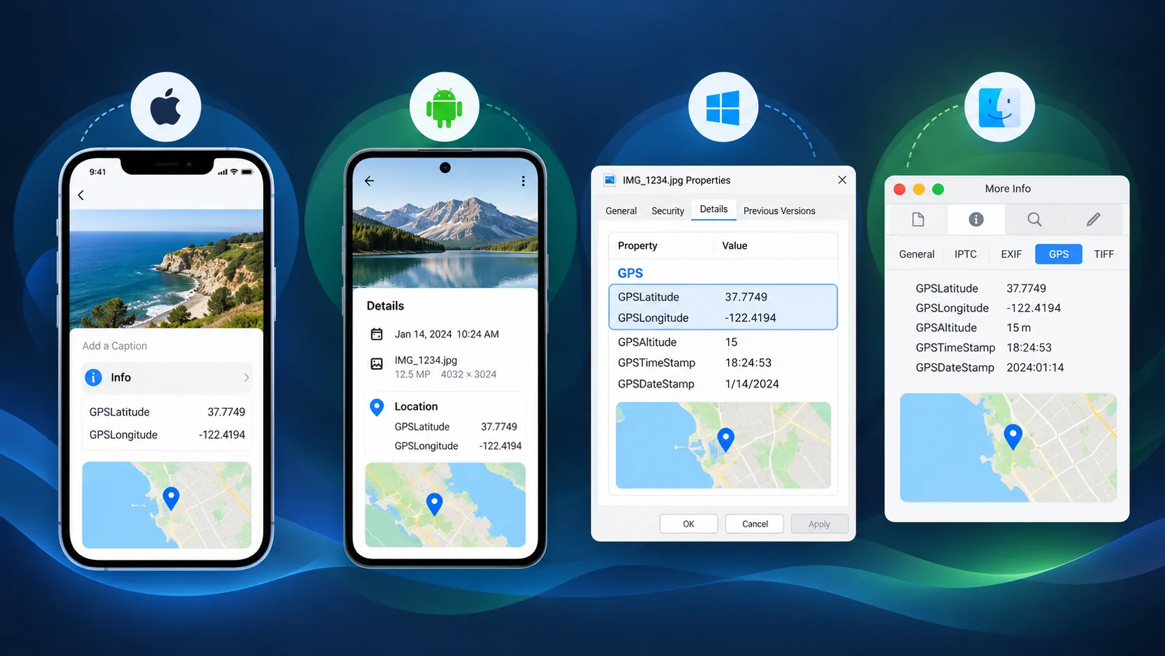 Four-panel illustration showing how to check photo GPS metadata on iPhone, Android, Windows, and macOS
Why a Photo Might Not Have GPS Data
If your check reveals no embedded GPS coordinates, it is usually because of one of these reasons:
Location services were disabled
If the phone or camera did not have location services enabled when the photo was taken, no GPS data was recorded. This is the most common reason for missing geotags on photos taken with your own device. On both iPhone and Android, camera location access can be toggled in Settings.
The file was processed by a platform or app
Many social media platforms and messaging apps may remove or alter metadata — including GPS coordinates — during upload, compression, or sharing. Behavior varies by platform, sharing mode, device, and app version.
If location privacy matters, inspect the actual received or downloaded file with a metadata viewer rather than assuming the metadata survived or was removed. Apple documents that sharing a photo can include associated metadata such as location, but specific behavior depends on the sharing method and recipient platform.
The safest approach: if you need to know whether a specific file contains GPS data, check the file itself rather than relying on assumptions about what a platform does or does not strip.
The file is a screenshot or edited copy
Screenshots normally do not contain the original camera GPS metadata because they capture screen content rather than camera sensor output. Location metadata could still be added later by software. Similarly, some image editing software strips metadata when saving, and certain file format conversions may discard EXIF GPS data.
The camera does not record GPS
Some cameras — particularly older digital cameras, webcams, and some action cameras — do not have GPS or location services and therefore never embed location data.
How to Read GPS Coordinates Once Found
GPS coordinates in EXIF metadata are typically stored in one of two formats:
Degrees, Minutes, Seconds (DMS):
48° 51' 24.0" N, 2° 21' 7.0" E
Decimal Degrees (DD):
48.8567, 2.3519
Both represent the same location (near the Eiffel Tower in Paris). Most metadata viewers and file inspectors display DMS format. To view the location on a map, you can paste either format into Google Maps, Apple Maps, or any mapping service.
The GeoImageTagger Metadata Viewer displays coordinates and provides a direct map link so you can see the location without copying coordinates manually.
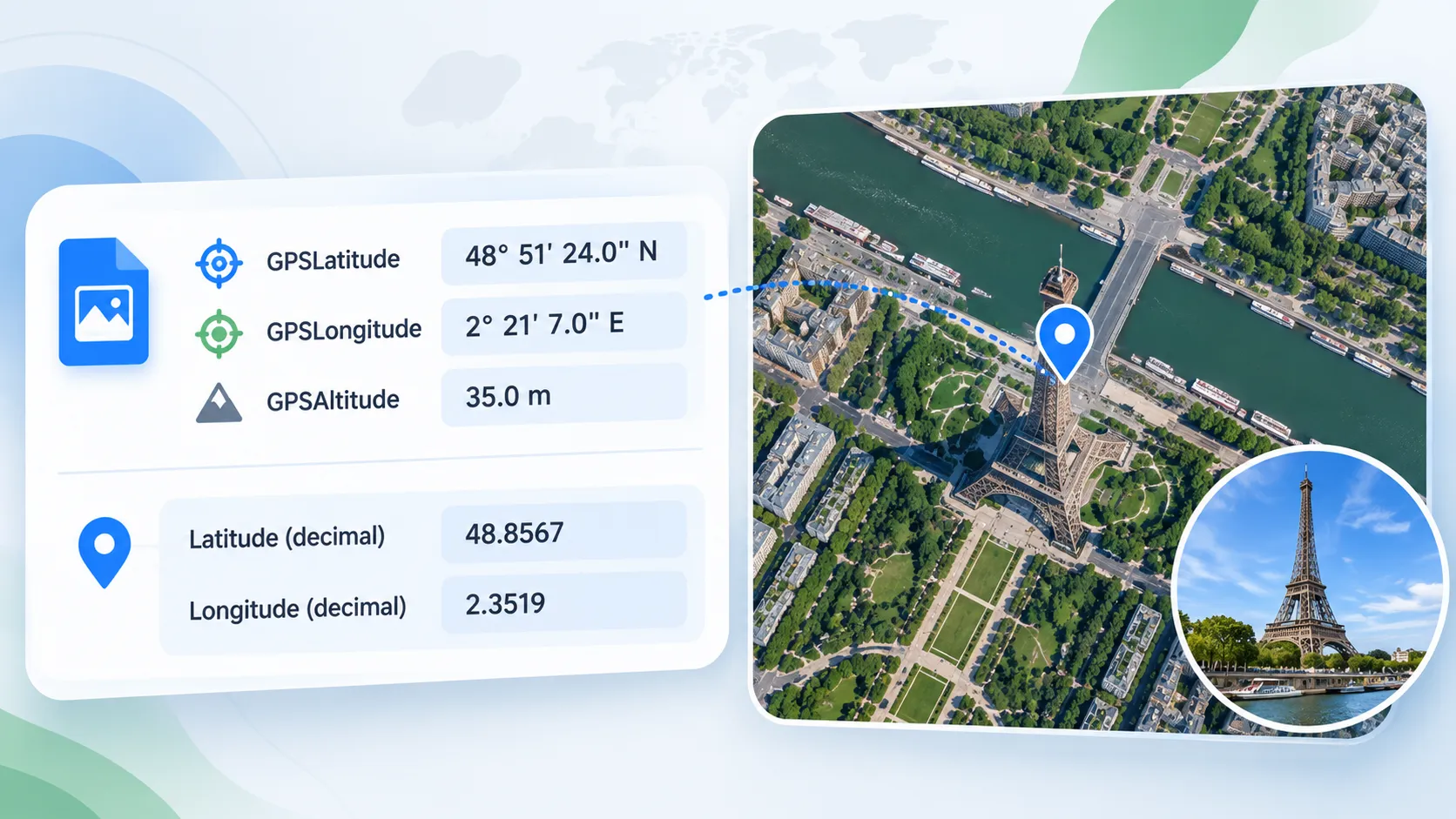 Example showing GPS coordinates in EXIF metadata displayed in both DMS and decimal degree formats with a map pin
What to Do After Checking
Once you know whether a photo has embedded GPS data, your next step depends on what you need:
GPS data exists and you want to keep it
No action needed. The geotag is embedded in the file and will be preserved as long as the file is not re-processed by software or platforms that modify metadata.
GPS data exists but you want to remove it for privacy
Before sharing photos publicly, you may want to strip the GPS coordinates to protect your location privacy. The GeoImageTagger EXIF Remover lets you remove all EXIF metadata (or selectively remove GPS data) before sharing. For more on why and how to do this, see the guide on how to remove EXIF data from photos.
GPS data is missing but you want to add it
If you know where a photo was taken and want to embed the coordinates — for example, for local SEO, photo organization, or archival purposes — the GeoImageTagger Metadata Editor lets you write GPS coordinates directly into the image file. For batch geotagging, the main GeoImageTagger platform handles multiple images at once with map-based coordinate selection.
GPS data is missing and you do not know the location
If a photo has no embedded GPS data and you want to estimate where it was taken, the GeoImageTagger AI Image Location Finder uses visual AI analysis to identify probable locations from architectural, terrain, and environmental clues in the image. This produces an AI estimate — useful as a starting point but not equivalent to embedded GPS data and always worth verifying.
For a complete overview of all location-finding methods, see the guide: How to Find Where a Photo Was Taken: 4 Methods That Actually Work.
Frequently Asked Questions
How do I know if my iPhone photo has location data?
Open the photo in the Photos app and swipe up or tap the ⓘ button. If a map appears, location information is associated with the photo. However, to confirm that GPS coordinates are actually embedded in the image file (as opposed to a location stored only in the Photos database), inspect the file with a metadata viewer such as the GeoImageTagger Metadata Viewer.
Do all photos have GPS data?
No. GPS data is only embedded if the device had location services enabled at the time of capture, and if the file has not been processed by software or platforms that modify metadata. Screenshots, edited copies, and photos processed by various apps and platforms may not contain embedded GPS data.
Can I check geotags without installing software?
Yes. Browser-based tools like the GeoImageTagger Metadata Viewer let you drag and drop any image to view all embedded metadata, including GPS coordinates, directly in your browser. No installation or signup required. This is also the most reliable way to confirm that GPS data is embedded in the file itself.
Do social media and messaging platforms remove GPS data from photos?
Many platforms may remove or alter metadata during upload, compression, or sharing. Behavior varies by platform, sharing mode, device, and app version. If location privacy matters, inspect the actual received or downloaded file with a metadata viewer rather than assuming the metadata survived or was removed.
What is the difference between a geotagged photo and AI location estimation?
A geotagged photo contains GPS coordinates recorded by the device at the time of capture — this is embedded data from the device's location services. AI location estimation analyzes the visual content of a photo (architecture, vegetation, signage) to estimate where it might have been taken — this is probabilistic and should be verified. For more on AI estimation tools, see the AI photo location finder tools comparison.
Conclusion
Checking if a photo is geotagged takes less than a minute on any device. Built-in photo apps on iPhone and Android can give you a quick indication of whether a location is associated with a photo. Windows file properties and macOS Preview can show embedded GPS fields directly. And browser-based tools like the GeoImageTagger Metadata Viewer provide the most reliable confirmation that GPSLatitude and GPSLongitude fields actually exist in the image file — distinguishing embedded EXIF data from locations that may have been added or estimated by a photo-management app.
Understanding whether your photos carry embedded GPS data is the first step — whether your goal is protecting your privacy before sharing, verifying where an image came from, or managing location data for SEO and archival workflows. From there, you can remove metadata, add coordinates, or investigate further using the right tool for the job.
← Back to Blog