How to Find Where a Photo Was Taken: 4 Methods That Actually Work
You found an old photo and want to know exactly where it was taken. Or someone sent you a picture and you are curious whether it reveals a specific location. Maybe you are a journalist verifying a source image, a traveler trying to remember a beautiful spot, or a parent checking whether your teenager's photo shows a safe location.
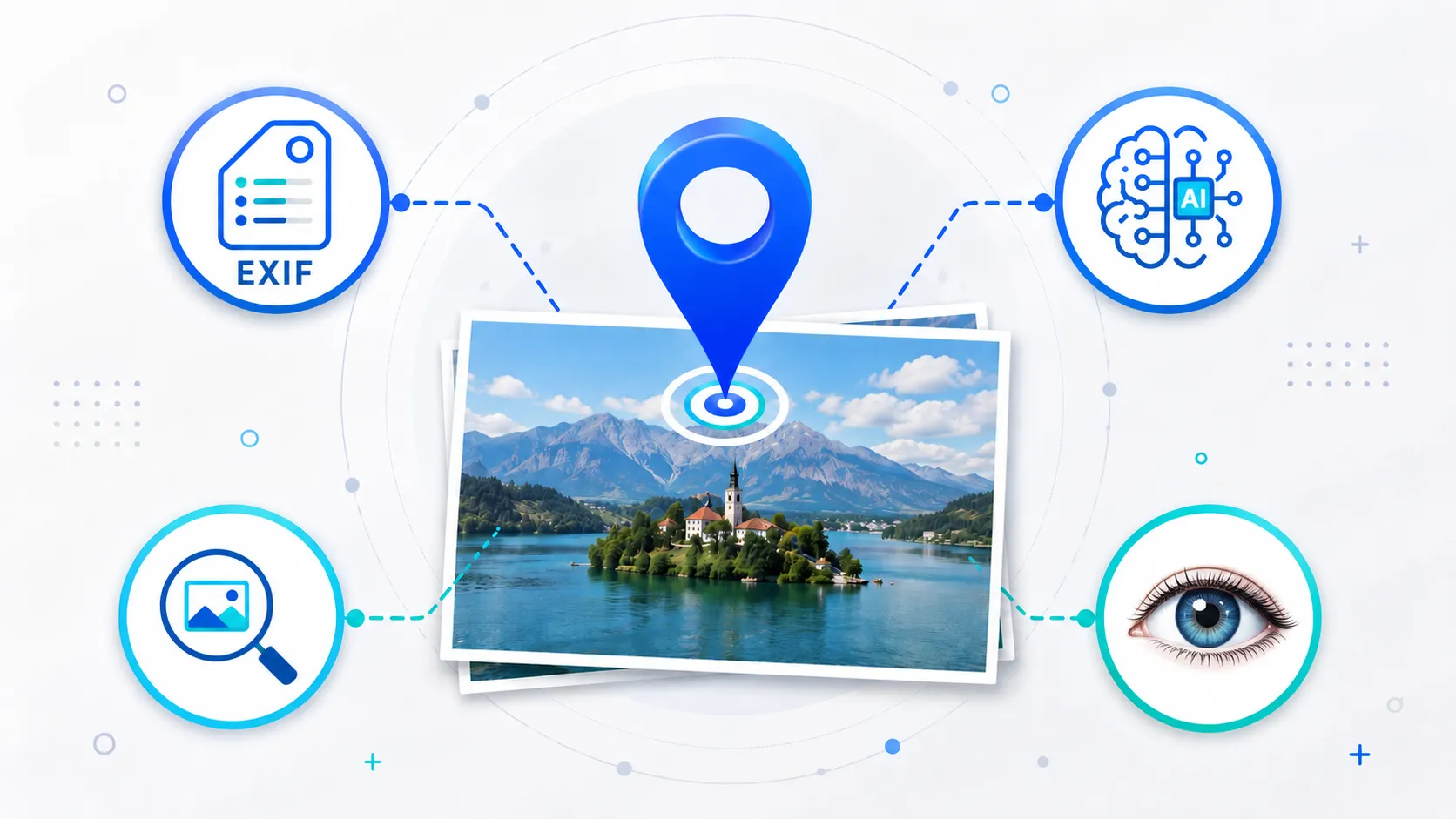
Whatever the reason, there are four practical methods to find where a photo was taken. Some give you exact coordinates in seconds. Others require more effort. The right approach depends on whether the original file still has its metadata intact, what platform it came from, and what kind of image you are working with.
Method 1: Check the photo's EXIF metadata
The fastest way to find a photo's location is to check whether it already contains GPS coordinates. Most smartphones embed latitude, longitude, altitude, and timestamp data into every photo automatically through EXIF metadata — as long as location services were enabled when the picture was captured.
This is the most reliable method because it gives you exact coordinates, often accurate to within a few meters.
How to check on different devices
On iPhone: Open the photo in the Photos app, then swipe up or tap the info icon. If GPS data exists, you will see a map showing where the photo was taken, along with the city and neighborhood name.
On Android: Open the image in Google Photos or your Gallery app. Tap "Details" or swipe up to view location information. Google Photos will show a map preview with the address.
On Windows: Right-click the image file, select Properties, go to the Details tab, and scroll down to the GPS section. You will see latitude and longitude values if they exist.
On Mac: Open the image in Preview, then go to Tools → Show Inspector → GPS tab to view coordinates and a map location.
Using online metadata tools
If you want a more detailed view — including not just GPS but also camera settings, timestamps, IPTC fields, XMP data, creator information, and descriptions — you can use a browser-based metadata viewer. The free Metadata Viewer shows EXIF, GPS, IPTC, XMP, camera data, and raw JSON metadata fields directly in your browser. Your file never leaves your device because all processing happens locally.
This is especially useful when you need to verify whether metadata survived a file transfer or conversion, or when you want to check multiple metadata fields at once instead of just GPS.
When this method fails
EXIF metadata is the most reliable way to find photo locations, but it has a critical limitation: most platforms strip this data when you upload or share images. If the photo passed through social media, the GPS coordinates are almost certainly gone.
Which platforms strip GPS metadata and which preserve it
Understanding which apps and services remove location data helps you decide when to try EXIF and when to skip straight to other methods.
Platforms that remove GPS metadata:
- Instagram, Facebook, X (Twitter), TikTok, Snapchat, LinkedIn, and Reddit all strip EXIF data from uploaded images
- WhatsApp removes metadata when photos are sent in standard photo mode, but preserves it when you send the photo as a document
- Telegram strips metadata in standard mode, but preserves it when you use "Send as file"
- Screenshots never contain GPS data because they capture the screen, not the camera sensor
- Most messaging apps that compress photos also strip metadata in the process
Methods that preserve metadata:
- Email attachments (Gmail, Outlook) send original files with full metadata intact
- Cloud storage sharing links (Google Drive, iCloud, Dropbox) share the original file
- iMessage generally preserves metadata for Apple-to-Apple transfers
- AirDrop preserves full metadata when set to send originals
- Direct file transfers via USB or cable keep all metadata intact
- Signal preserves metadata when photos are sent as files
If you received the photo through any social media platform or standard messaging, the GPS data is almost certainly gone. Move on to the next methods. But if you have the original file from email, cloud storage, or a direct transfer, always check EXIF metadata first — you might have exact coordinates waiting.
Method 2: AI-powered location detection
When a photo has no GPS metadata — because it was shared on social media, taken with a camera that had location services disabled, or had its metadata manually stripped — AI can analyze the visual content of the image to estimate where it was taken.
How AI geolocation works
Modern AI geolocation systems use computer vision models trained on millions of geotagged images from around the world. The process typically works in layers:
- Feature extraction. The AI identifies visual elements like architectural styles, road markings, vegetation types, signage languages, terrain features, power line configurations, and distinctive landmarks
- Pattern matching. These features are compared against reference databases to narrow down the geographic region
- Hierarchical refinement. The system first estimates the continent or country, then narrows to a city or region, and finally attempts street-level identification when enough visual clues exist
- Confidence scoring. Results include probability estimates so you can judge how reliable the prediction is
Strengths and limitations
AI geolocation works best with:
- Photos containing visible landmarks, monuments, or well-known buildings
- Street-level images with signs, road markings, traffic lights, or license plates
- Scenic landscapes with recognizable geographic features like coastlines, mountain ranges, or rivers
- Urban environments with distinctive architecture — Mediterranean, Nordic, Southeast Asian, and Latin American styles are usually identifiable
It struggles with:
- Indoor photos with no windows or location clues
- Heavily cropped, blurry, or low-resolution images
- Generic environments like parking lots, plain walls, basements, or undifferentiated forests
- Night photos with limited visual information
- Photos intentionally taken to hide location context
Tools for AI photo location detection
Several tools can analyze an image's visual content to estimate location:
General AI assistants like ChatGPT, Google Gemini, and Claude can analyze uploaded photos and attempt to identify locations based on visible features. They work best with recognizable landmarks, distinctive architecture, and readable text in the image.
Dedicated AI geolocation tools are purpose-built for location detection. The AI Location Finder uses visual AI analysis combined with EXIF GPS data when available. You upload an image, the AI analyzes landmarks, scenery, architecture, road features, and contextual clues, and returns a location estimate with confidence level. It works directly in the browser with no account required.
The advantage of a dedicated tool over a general AI assistant is that it is optimized specifically for location detection rather than general conversation, and it automatically checks existing EXIF GPS data as a first step before running visual analysis.
If you want to compare dedicated AI geolocation options before choosing one, see our comparison of the best AI photo location finder tools in 2026. It compares GeoImageTagger’s AI Image Location Finder with GeoSpy, Picarta, GeoAxis, Oceanir, GeoSeer, and Google Lens across pricing, features, privacy approaches, and different use cases.
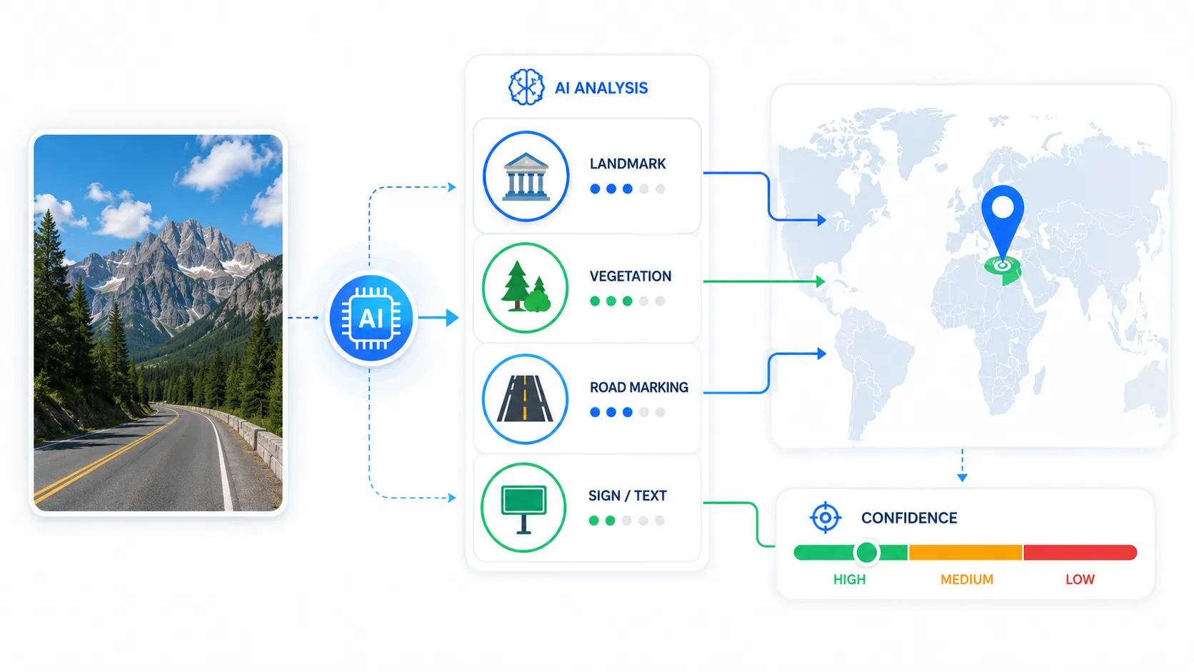 Diagram showing how AI analyzes photo features like landmarks, architecture, vegetation, and road markings to estimate geographic location
Method 3: Reverse image search
If the photo has been published online before — on a news site, travel blog, stock photo platform, or social media — a reverse image search can help you find the original source, which often includes location information in its caption or description.
Tools for reverse image search
Google Lens is the most widely available option. Upload an image or paste a URL, and Google will find visually similar images across the web. If the photo shows a recognizable landmark, Google Lens will often identify it by name and provide a Google Maps link directly.
Yandex Image Search is particularly effective for identifying locations in Eastern Europe, Central Asia, and Russia. It often returns different and more useful results than Google for images from those regions.
TinEye specializes in finding where an image first appeared online, which can help verify the original context and location.
Bing Visual Search provides results similar to Google Lens and can sometimes surface different sources, especially from Microsoft-indexed sites and forums.
Limitations
Reverse image search only works if the photo or a similar image already exists on the public web. For private photos, unpublished images, or original content that has never been uploaded elsewhere, this method will not return useful results. It also cannot determine the exact GPS coordinates — it can only help you identify what the image shows or find the original source.
Method 4: Manual visual analysis
Sometimes the best approach is the simplest: look at the photo carefully and identify visual clues that reveal the location.
What to look for
- Text and signage. Street signs, store names, highway markers, and text on billboards reveal language, city names, and sometimes exact addresses. Even partial text can narrow down a region.
- License plates. Plate formats, colors, dimensions, and character patterns vary by country and often by state or province. A visible plate can immediately identify the country.
- Architecture. Building styles, roof shapes, window patterns, facade materials, and construction methods are often region-specific. Mediterranean whitewash looks different from Scandinavian wood cladding or South Asian concrete construction.
- Vegetation. Palm trees versus pine forests, tropical plants versus desert scrub — vegetation is a strong regional indicator.
- Road features. Lane markings, traffic light styles, road surface quality, bollard designs, and driving side (left versus right) narrow down the country.
- Sun position and shadows. Shadow angles indicate hemisphere and approximate latitude. Long shadows suggest high latitudes or early/late hours.
- Utility infrastructure. Power line styles, telephone poles, transformer designs, and antenna configurations differ by region and country.
- Currency and prices. Visible price tags, menus, or currency symbols on signs can identify the country.
This approach requires patience and some geographic knowledge, but it works on any image regardless of whether metadata or AI tools are available.
Privacy considerations
The ability to find where a photo was taken is powerful, and that power cuts both ways. The same techniques that help a traveler rediscover a beautiful location can also reveal someone's home address, workplace, or daily routine.
Protecting your own privacy
If you share photos publicly, consider stripping GPS metadata before posting. The free EXIF Remover lets you selectively remove GPS coordinates, camera info, timestamps, and other hidden metadata directly in the browser. You can choose to strip everything or keep certain fields like copyright information.
You can also disable location services for your camera app to prevent GPS data from being recorded in the first place.
When metadata removal matters most
- Photos taken at your home or regular locations
- Images of children or family members
- Client site photos in professional services
- Medical, legal, or insurance documentation
- Any image that could reveal sensitive daily routines
- Photos shared on platforms that might preserve metadata (email, cloud storage, forums)
Even if you plan to post on a platform that strips metadata, removing it yourself before uploading is the only way to guarantee your location stays private. Platform policies change, edge cases exist, and not every sharing method strips data consistently.
Choosing the right method
| Scenario | Best method | Tool |
|---|---|---|
| Original photo from a phone or camera | Check EXIF metadata | Metadata Viewer |
| Photo received via email or cloud link | Check EXIF metadata first | Metadata Viewer |
| Social media download or screenshot | AI visual analysis | AI Location Finder |
| Photo published on a website or news article | Reverse image search | Google Lens, TinEye, Yandex |
| Photo with visible signs, text, or landmarks | Manual visual analysis | Your own observation |
| Need to add location data to a photo | Metadata editing | Metadata Editor |
| Need to remove location before sharing | Metadata stripping | EXIF Remover |
For the most reliable results, combine methods. Start with EXIF metadata — if GPS data exists, you have an exact answer in seconds. If not, try AI detection for an estimate, then verify with reverse image search or visual clues.
 Visual comparison of four methods to find photo location showing EXIF metadata check, AI detection, reverse image search, and visual analysis with use cases
If you want a broader workflow that covers geotagging, AI descriptions, metadata editing, and image optimization in one platform, GeoImageTagger brings those capabilities together. You can explore the full workflow on How It Works and review capabilities on the Features page.
Frequently asked questions
Can you find the exact location of any photo?
Not always. If the photo has GPS metadata, you can find the exact coordinates — often accurate to within a few meters. If metadata has been stripped, AI tools can estimate the location but accuracy varies depending on the visual content. Indoor photos with no distinctive features may not be identifiable at all.
Does WhatsApp remove location data from photos?
It depends on how the photo is sent. Standard photo sharing in WhatsApp strips EXIF metadata including GPS coordinates. However, sending a photo as a document preserves all original metadata, including exact location data. Telegram works the same way — standard sends strip metadata, but sending as a file preserves it. If privacy matters, strip metadata before sending regardless of the method.
Does Instagram remove photo location data?
Yes. Instagram strips all EXIF metadata from uploaded photos, including GPS coordinates, camera information, and timestamps. The location you see on Instagram posts comes from the user manually tagging a place in the app, not from the photo's embedded GPS data.
Can AI really identify where a photo was taken?
Yes, modern AI geolocation models can identify locations by analyzing landmarks, architecture, vegetation, road markings, and other visual clues. Accuracy is highest in well-documented urban environments and areas with distinctive features. Results are less reliable in generic or rural settings. AI works best as an estimation tool — it narrows down the region, and you verify from there.
How accurate is GPS data in photos?
Smartphone GPS is typically accurate to within 3–5 meters under good conditions (clear sky, no tall buildings). In dense urban areas or indoors, accuracy can drop to 10–30 meters. The GPS coordinates in EXIF metadata reflect the accuracy of the device at the time of capture.
How do I add location data to a photo that does not have it?
You can use a metadata editor to write GPS coordinates into the image file. The Metadata Editor lets you add or modify EXIF, IPTC, and XMP fields directly in the browser — including GPS coordinates, copyright, and description fields.
Should I remove location data before sharing photos online?
If the photo reveals a private location — your home, a client's property, a child's school — yes, remove it. If the photo shows a public venue, business storefront, or tourist location, the risk is generally low. The safest approach is to strip metadata from any photo you share publicly and rely on captions or page context to communicate location when needed.
Can you find where a screenshot was taken?
No, not from metadata. Screenshots capture what is on the screen, not what the camera sensor sees. They contain no GPS data. However, if the screenshot shows identifiable content — like a map, a street view, or a location-specific app — you might be able to identify the location from what is visible in the image using AI analysis or manual inspection.
Which method is most reliable for finding photo locations?
EXIF metadata is the most reliable because it gives you exact coordinates recorded by the device at capture time. When metadata is unavailable, AI geolocation is the next best option for estimating the location, followed by reverse image search for published images and manual visual analysis as a fallback. Combining multiple methods gives you the highest confidence in the result.
Conclusion
Finding where a photo was taken is easier than most people expect when you use the right method. EXIF metadata gives you instant, precise coordinates if the data exists. AI location detection fills the gap when metadata has been stripped. Reverse image search and manual visual analysis provide additional options for published or feature-rich images.
The most important thing is knowing which method fits your situation — and understanding the privacy implications of location data in photos, whether you are trying to find it or trying to protect it.
← Back to Blog