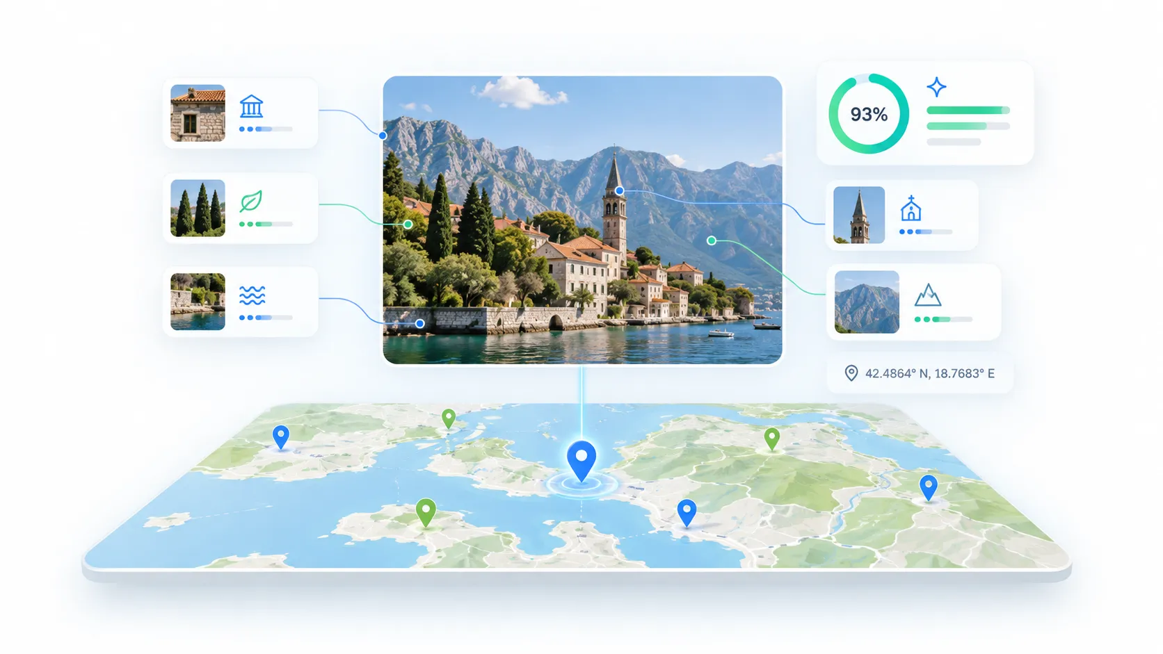
Best AI Photo Location Finder Tools in 2026: Free & Paid Options Compared
You have a photo and no idea where it was taken. Maybe the GPS metadata was stripped by social media, or the image was shared without context. AI-powered photo location finders can analyze visual clues — architecture, vegetation, signage, terrain — and estimate where the photo was captured.
But not all AI location finders work the same way. Some are built for casual use, others for professional investigations. Some offer free access, others cost hundreds per month. And the type of output varies significantly depending on the tool, the image, and the region.
This guide compares the leading AI photo location finder tools available in 2026, with transparent details on pricing, features, privacy approaches, and use-case fit.
How AI Photo Location Finders Actually Work
Before comparing tools, it helps to understand the two fundamentally different ways a photo's location can be determined:
1. EXIF/GPS metadata extraction. Many cameras and smartphones embed GPS coordinates directly into a photo's file metadata. If that data exists, the location is exact. You can check this with any metadata viewer — no AI required.
2. Visual AI geolocation. When metadata is missing (stripped by social media, taken with a camera that does not record GPS, or intentionally removed), AI models analyze the visible content of the image. They look for recognizable architecture, terrain patterns, vegetation types, road markings, signage language, and other contextual clues to estimate a probable location.
Most dedicated AI photo location finders focus primarily on visual analysis but may also check for embedded GPS data as a first step. The best tools clearly distinguish between these two sources so you know whether a result comes from hard metadata or an AI estimate.
AI Photo Location Finder Tools Compared
Here is a feature and pricing comparison of the leading tools available in 2026:
| Tool | Best For | Free Option | Paid Pricing | Signup Required | EXIF Check | AI Visual Analysis | Confidence Score | Report Export |
|---|---|---|---|---|---|---|---|---|
| GeoImageTagger AI Image Location Finder | SEO workflows, metadata + location | Yes (2/day) | Pro $10/mo (5/day) | Optional for free tools | Yes | Yes (Gemini AI) | Yes | PDF, PNG, 15 languages |
| GeoSpy | Quick lookups | iPhone app free trial | $39 lifetime (web) | Google account (web) | Yes | Yes | No / not clearly exposed | No |
| Picarta | General location search | 1 search | $15.90/20 searches or $59.90/mo | Yes | No | Yes (vision transformers) | Yes | No |
| GeoAxis | OSINT professionals | Free trial | Pro $29.99/mo, Business $79.99/mo | Yes | No | Yes | Yes (claims HyperVision accuracy within 10 meters in indexed cities) | No |
| Oceanir | OSINT investigations, evidence chains | Yes (basic) | Starter $10/mo, Pro $29/mo | Yes | No | Yes | Yes | PDF/CSV (Pro) |
| GeoSeer | OSINT multi-agent analysis | Limited free | Starter $19/mo, Pro $69/mo | Optional for limited use | No | Yes (multi-agent) | Yes | No |
| Google Lens | Landmark identification | Free | Free | Google account | No | Yes (landmark matching) | No | No |
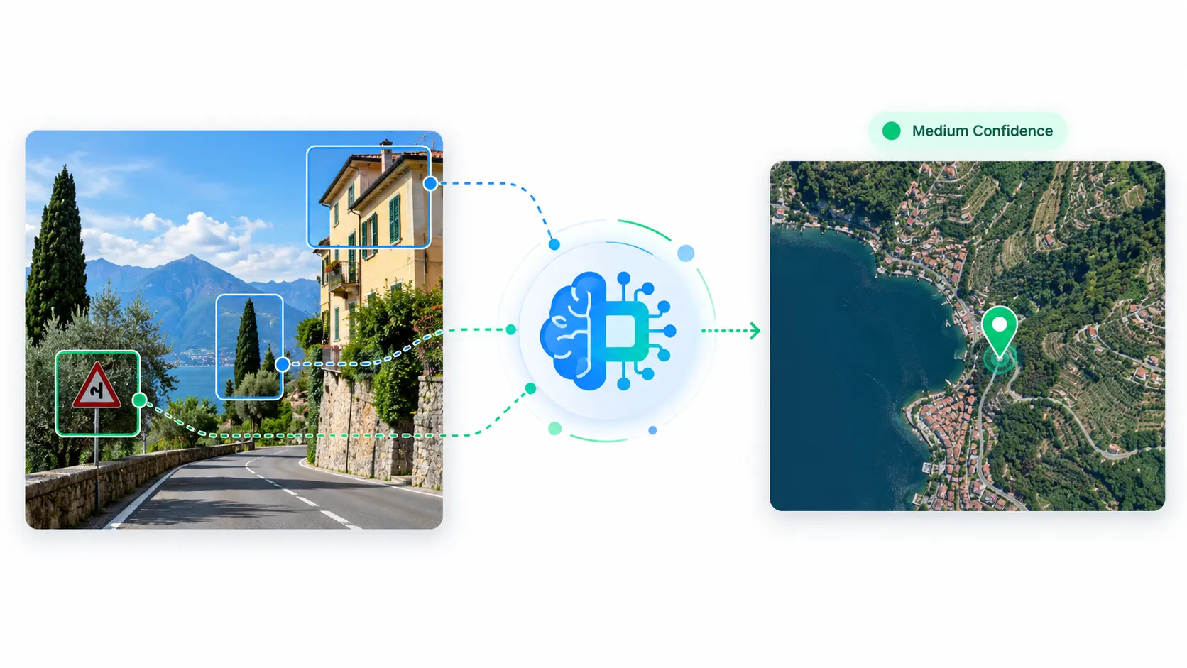 Illustration showing how AI photo location tools analyze visual clues like architecture, vegetation, and signage to estimate where a photo was taken
Individual Tool Breakdown
GeoImageTagger AI Image Location Finder
The GeoImageTagger's AI Image Location Finder takes a different approach from OSINT-focused tools. It combines AI visual geolocation with EXIF metadata checking in a single workflow.
When you upload an image, it first checks for embedded GPS coordinates. If none exist, it uses Google Gemini AI to analyze visual clues and estimate a location. Results include a confidence score (high, medium, low, or none), detailed visual clue annotations, AI reasoning, and an interactive satellite map. It also cross-references EXIF GPS and AI estimates when both exist, flagging discrepancies.
A key differentiator is the exportable analysis report. You can download the full location analysis as a PDF or PNG file, and the generated report can be translated into 15 languages — useful for teams working across regions or documenting findings for multilingual clients.
The AI Location Finder is free to use without an account (2 analyses per day on the free plan; 5 per day on the Pro plan at $10/month). It pairs naturally with GeoImageTagger's other tools — after identifying a location, you can use the main geotagging platform to write GPS coordinates into image EXIF metadata, or use the metadata viewer to inspect what data already exists.
Regarding privacy, the AI Location Finder states: "Your images are processed securely and deleted immediately after analysis. We do not store, share, or use your images for any purpose beyond this analysis."
Strengths: Combined EXIF + AI workflow, confidence scoring, downloadable PDF/PNG reports, 15-language report translation, free tier without signup, SEO and metadata integration. Limitations: Focused on location identification and metadata workflows rather than deep OSINT investigation.
GeoSpy
GeoSpy is one of the most recognized consumer-facing AI geolocation tools. Upload a photo and receive a city-level location estimate plotted on a map. The interface is minimal and fast. GeoSpy states that it reads EXIF GPS data when present in the uploaded image.
Web-based photo analysis is available through the $39 lifetime purchase (a one-time payment, not a subscription). Access is tied to a Google account. GeoSpy also offers an iPhone app with a free trial. For professional use, GeoSpy's team launched Raven, an enterprise platform with vehicle identification, deepfake detection, and case management — but that requires custom licensing through Graylark.io.
Strengths: Simple interface, low-cost lifetime option, EXIF GPS reading, iPhone app with free trial. Limitations: Provides city-level estimates rather than precise addresses. No detailed confidence metrics or evidence explanations in the consumer version. Professional features locked behind enterprise licensing.
Picarta
Picarta uses vision transformer models to estimate photo locations. It provides GPS coordinates plotted on an interactive map with candidate locations and confidence indicators. It also offers landmark detection.
The free tier provides 1 search. Paid options include a one-time wallet ($15.90 for 20 searches) or a monthly subscription ($59.90/month for 100 searches). Production API access is listed for Enterprise accounts and is not included in standard consumer plans.
Strengths: Vision transformer architecture, landmark detection, flexible payment options (per-search or subscription). Limitations: Free tier is extremely limited (1 search). API access restricted to Enterprise accounts. Subscription pricing is relatively high for the included search volume.
GeoAxis
GeoAxis markets itself to OSINT professionals and claims HyperVision accuracy within 10 meters in indexed cities. It supports batch processing of up to four images simultaneously and offers an enterprise HyperVision product for custom city deployments.
Pricing tiers: Pro at $29.99/month, Business at $79.99/month, and Enterprise at custom pricing. The Pro plan does not include API access. Business includes limited API access, and Enterprise provides broader API capabilities. A free trial is available.
Strengths: Batch processing, stated HyperVision accuracy within 10 meters in supported indexed cities, OSINT focus, tiered API access. Limitations: The HyperVision accuracy claim (within 10 meters) is limited to indexed cities — GeoAxis states this capability, but performance outside those areas may vary. API access requires the Business tier or higher.
Oceanir
Oceanir differentiates itself through evidence-based reasoning. Rather than providing a coordinate alone, it highlights the specific visual clues (sidewalk tiles, vending machines, architectural patterns) that led to its estimate.
Oceanir offers a free tier for basic checks, a Starter plan at $10/month (30 credits), and a Pro plan at $29/month (100 credits). A D3 (Depth 3) forensic-level analysis uses 10 credits. Additional credit packs can be purchased at approximately $0.60–$0.80 per credit. Note that Oceanir does not directly process video files — users extract a still frame from video and upload the frame for analysis. Pro-tier users can export evidence as PDF or CSV files.
Regarding privacy, users should review Oceanir's current privacy documentation for specifics on data handling and retention, as policies may differ between tiers.
Strengths: Transparent evidence chains, credit-based flexibility, forensic-depth analysis, PDF/CSV evidence export (Pro). Limitations: D3 analysis consumes 10 credits per image, which adds up at scale. No direct video processing. Geographic coverage for precise pinpointing is limited to certain areas.
GeoSeer
GeoSeer uses a multi-agent AI architecture where several models analyze different aspects of an image in parallel. It offers two modes: Agent Mode for deep investigation with hypothesis branching, and Fast Mode for rapid triage.
The free tier includes limited daily usage (1 web search/day, 10 total API calls). Starter is $19/month (100 web searches and API calls), Pro is $69/month (unlimited web searches, 1,000 API calls). Enterprise offers custom pricing. Annual billing is available and reduces the effective monthly rate.
Strengths: Multi-agent analysis, dual operating modes, API integration across paid tiers. Limitations: Free tier is very restricted. Pro pricing at $69/month is significant for individual users.
Google Lens
Google Lens is not a dedicated location finder, but it effectively identifies locations containing well-known landmarks, buildings, or signs by matching visual patterns against Google's image index. It is free and built into most Android devices and Chrome.
Strengths: Free, widely available, effective for recognizable landmarks. Limitations: Not designed for general geolocation. Limited effectiveness on generic landscapes, interiors, or images without distinctive features. No coordinate output or confidence scoring.
Which Tool Should You Use?
The right tool depends on your specific need:
| Use Case | Recommended Tool | Why |
|---|---|---|
| SEO and image metadata workflows | GeoImageTagger AI Image Location Finder | Combines location finding with EXIF writing, metadata editing, tag generation, and exportable reports |
| Quick affordable lookup | GeoSpy | $39 lifetime, simple interface, city-level estimates |
| Professional OSINT investigation | GeoAxis or Oceanir | Stated HyperVision accuracy within 10 meters (GeoAxis), evidence chains and forensic depth (Oceanir) |
| API integration (Enterprise) | Picarta or GeoSeer | Enterprise API deployment (Picarta), tiered API access (GeoSeer) |
| Identifying famous landmarks | Google Lens | Free, instant, works on any device |
| Budget-conscious regular use | GeoImageTagger AI Image Location Finder | Free tier (2/day) + $10/mo Pro with downloadable reports |
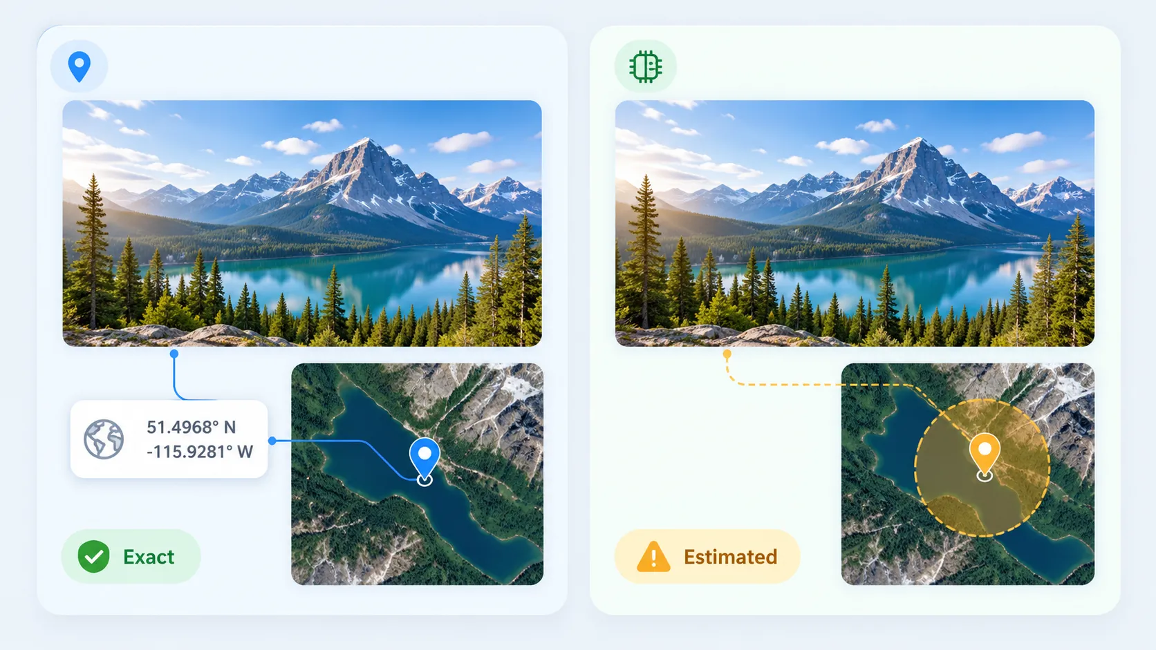 Side-by-side comparison showing GPS metadata providing exact coordinates versus AI estimation showing a probability zone on a map
Understanding Confidence and Limitations
Every AI photo location finder has significant limitations that honest comparison should acknowledge:
- AI estimates are not GPS coordinates. An AI-generated location is a probabilistic guess, not an exact measurement. Even results labeled as "high confidence" should be verified independently.
- Generic scenes are hard. A photo of a grassy field, a plain building interior, or a parking lot will challenge every tool. Visual geolocation works best with distinctive architecture, signage, or landscape features.
- Regional coverage varies. Most tools perform better in well-documented urban areas (major cities, tourist destinations) and may be less effective in rural or less-photographed regions.
- Confidence scores are not standardized. Each tool calculates and labels confidence differently. A "high confidence" on one platform is not directly comparable to the same label on another.
- Vendor-stated accuracy is not independently verified. When tools claim specific precision levels (such as meter-level accuracy), those are vendor-reported capabilities. Independent benchmarking across tools has not been conducted for this comparison.
When high accuracy matters, cross-reference results between tools and verify against satellite or street-view imagery. For workflows where you need to actually embed verified GPS data into images, a tool like GeoImageTagger lets you review the AI's suggestion, adjust coordinates if needed, and then write the verified location directly into the image's EXIF metadata.
GPS Metadata vs. AI Estimation: Know What You Are Getting
One critical distinction that most comparison articles overlook: there is a fundamental difference between finding a location from embedded GPS metadata and estimating one from visual analysis.
If an image contains EXIF GPS data, the location is typically accurate to within a few meters. You can verify this instantly using a metadata viewer. No AI is needed, and the result is factual.
If that data is missing — because social media stripped it, the camera did not record it, or someone used an EXIF remover — then AI visual analysis is the only automated option. But the result is always an estimate with varying degrees of certainty. Understanding this distinction prevents overreliance on AI estimates in situations where precision matters.
For a broader overview of all methods for finding where a photo was taken — including manual techniques and reverse image search — see our detailed guide: How to Find Where a Photo Was Taken: 4 Methods That Actually Work.
Frequently Asked Questions
What is the most accurate AI photo location finder?
Each tool reports different capabilities and precision levels. Tools like GeoAxis claim HyperVision accuracy within 10 meters in certain indexed cities, while others provide city- or region-level estimates. Accuracy depends heavily on the specific image — distinctive landmarks produce better results than generic scenes. No single tool is universally most accurate, and vendor-stated precision should be verified for your specific use case.
Can AI find the exact location of any photo?
No. AI photo location finders estimate probable locations based on visual patterns. They work best with images containing distinctive landmarks, architecture, or signage. Generic scenes (plain interiors, open fields) may produce low-confidence or incorrect results. Always verify AI estimates independently.
Are free AI location finders functional?
Free tiers from tools like the GeoImageTagger's AI Image Location Finder (2/day), GeoSpy (iPhone app trial), and GeoSeer (limited daily use) provide genuine AI analysis. Free plans typically limit usage volume rather than analysis quality. For occasional use, free options are often sufficient.
Do these tools store my photos?
Retention policies differ significantly by provider. The GeoImageTagger's AI Image Location Finder states that images are processed securely and deleted immediately after analysis. Other tools make similar claims, but specific policies vary by provider and tier. Always check each provider's current privacy policy before uploading sensitive images.
What is the difference between EXIF GPS data and AI-estimated location?
EXIF GPS data is exact coordinates recorded by the camera hardware at the time of capture. AI-estimated location is a probabilistic guess based on visual analysis of the image content. EXIF data is factual; AI estimation is inferential. The best workflows check for EXIF data first and use AI only when metadata is absent.
Conclusion
The AI photo location finder space in 2026 offers genuine options across different price points and use cases. For SEO professionals and teams managing image metadata, the GeoImageTagger's AI Image Location Finder provides an integrated workflow combining location detection with metadata management and exportable multilingual reports. For OSINT investigators, dedicated tools like GeoAxis and Oceanir offer deeper investigation features with evidence-based output. For quick affordable lookups, GeoSpy's $39 lifetime option keeps things simple.
The most important takeaway: no AI tool is infallible. Use confidence indicators critically, verify important results, and understand the difference between GPS metadata and AI estimation. When you do find or confirm a location, tools that let you write verified GPS data back into your images complete the workflow from discovery to documentation.
← Back to Blog